Research Article: 2021 Vol: 24 Issue: 1S
Gravity Anomalies and Regional Geological Structures Between Lake Tondano Caldera and Lake Linow Crater for Geothermal Energy Exploration in North Sulawesi Indonesia
Cyrke A.N. Bujung, Universitas Negeri Manado
Donny R. Wenas, Universitas Negeri Manado
Abstract
North Sulawesi Indonesia has many natural resources that can be used as geological tourism object, including Lake Tondano and Lake Linow. In addition to the natural beauty of the lake itself, there are also geological phenomena in the form of the appearance of many geothermal manifestations, which indicate the existence of a permeable zone between the two areas. It is interesting to examine whether there is a geological structure that connects the two lakes which can then be used as information and recommendations for the development of geothermal energy exploration in North Sulawesi. This study aims to determine the existence and direction of subsurface geological structures based on gravity anomaly data, and the presence of surface geological structures based on line density in the area between Lake Tondano and Lake Linow. The gravity method is used to obtain information about the geological structure of the area between Lake Tondano and Lake Linow which is characterized by contrasting gravity anomalies, which are then interpreted as geological structures in the form of faults. In addition to the gravity method, the lineament method is also used to determine the surface geological structure of the area between Lake Tondano and Lake Linow. The results showed that there was a fault in the Lake Tondano area and its surroundings which was trending east-west to southeast. This is known based on the distribution of bouguer anomaly values that increase towards the eastern part of Lake Tondano with a value of 154 - 168 mGal. Based on the analysis of lineament density, it is known that the surface geological structure around Lake Tondano extends in the southeast-northwest direction which is an extension of the structure between Lake Tondano and Lake Linow. The results of this study conclude that the development trend of geothermal energy exploration extends from the northwest of Lake Linow to the southeast of Lake Tondano.
Keywords
Gravity Anomaly, Geological Structures, Geothermal Exploration
Introduction
Geothermal energy is one of the alternative energy sources that is new and renewable and environmentally friendly. North Sulawesi Indonesia is known to be rich in geothermal energy because it has many active volcanoes that form subsurface geothermal systems (Figure 1). The formation of geothermal systems is influenced by geological processes that have occurred or are occurring along volcanic arcs. The geological process in question is the magmatic activity and the appointment process. The activity of magma, especially volcanoes, is manifested in the form of volcanic breakthroughs and eruptions. While the lifting process will result in the formation of geological structures such as faults along the volcanic path. Geological structure plays an important role in the formation of geothermal systems; therefore it needs to be studied to determine the direction of opening or continuity of geological structures which will later contribute to recommendations in the exploration of geothermal energy, especially in areas along the Lake Tondano to Lake Linow. Based on geological investigations, Lake Tondano is a giant hole formed by the eruption of the large Tondano volcano at the end of the Tertiary period and the beginning of the Quater period which is then filled with surface runoff. Whereas, the Linow Lake basin is geologically considered a natural crater of the eruption that occurred around 0.5 million years ago. Lake Linow is located in the Lahendong geothermal field. There are various geothermal manifestations such as hot springs, fumaroles, mud pools, and other geothermal manifestations in the area around and along Lake Tondano to Lake Linow. Several studies have been conducted, focusing on two separate locations, namely in the area around Lake Tondano alone and in the area around Lake Linow alone, while the area connecting the two locations has not been specifically studied. The purpose of this study is to investigate subsurface and surface geological structures along the area between Lake Tondano to Lake Linow. Subsurface geological structures are characterized using the gravity method to determine fault zones, while surface geological structures are characterized using line density analysis along Lake Tondano to Lake Linow area. This combined method is used to gain knowledge about the potential of geothermal energy contained under the surface which covers the areas of Lake Tondano to Lake Linow.

Figure 1: The Location of The Study Area
Regionally, North Sulawesi is made by several fault systems, which making "block faulting", located along the north of the Sulawesi peninsula, began from Limboto to Lake Tondano. This zone is called a longitudinal depression Limboto formed at the time of Plio-Plistocene or together with removal to the west and east of Minahasa. Geologically, geological slices Minahasa is still intertwined with the Sangihe volcano range. An eruption the massive volcano of Tondano in the late period of Tertiary and geological times the beginning of time Quater formed a giant pit (crater). Tondano Lake caldera is formed due to the filling of crater by surface runoff from the surrounding mountains in the Minahasa geanticlin valley that borders with the Lembean ravine in the southeast and the ranks young volcanoes, namely Soputan, Tampusu, and Mahawu. Type of material parent rock around Lake Tondano is most commonly found Tondano tuff volcanic rocks and young volcanic rocks. Rock this is the result of volcanic activity from a volcano around Lake Tondano. The geological structure of the Lake Tondano area is dominated by volcanic rock, tuva Tondano, old volcanic rock, sediment lakes and rivers, alluvium. Volcanic rocks form volcanoes young strata who are still partly active, like Mount Soputan removing basal lava, lapilli and ash material. Tufa Tondano formed from rough volcanic clusters which are generally of a nature andesite which is composed of angular to angular components responsibility and is characterized by numerous floating pumice and tuva. These pyroclastic deposits are thought to originate from a great eruption on the time of the Tondano caldera. Old volcanic rocks generally consist on andesite to basal breccias, lava and tuva. Sediment lakes and rivers in the form of sand, dust, conglomerates and clay (Ministry of Environment and Forestry, 2015).

Figure 2: Lines Along Tondano Lake Caldera to Linow Lake Crater
Between Lake Tondano and Lake Linow lies Mount Tampusu. Tampusu volcanic products (±1500 m above sea level) are part of the Pangolombian Formation, where at the top of the mountain there is a crater lake (Figure 2). Rock sediments from the rock groups are quite widespread around Mount Tampusu. The types of rocks exposed on the surface are lava and pyroclastic which are composed of andesitic to basaltic compositions, generally composed of andesitic basaltic compositions. Lake Linow is in the middle of the Lahendong geothermal field. Linau's volcanic material consists of andesite and basalt composition and lava pyroclastic deposits, exposed around the crater walls and around the edge of Lake Linow. Besides that, also formed breccia mud deposits from hydrothermal eruptions. Other surface deposits are found around Lake Linow, the foot of Mount Tampusu and Kasuratan consist of and eroded rocks from the eruption of Mount Tampusu and Kasuratan. The material consists of a mixture of lava, colluvium, alluvium (sand, silt) forming steps, and a layer of clay with a thickness of 20-30 cm. The shredded material is composed of andesitic up to dacitic compositions. The Linau hydrothermal eruption crater reflecting rather a hilly topography (Siahaan, 2005). The complex tectonic setting combined with rich volcanic activity resulted in lots of calderas and faults in the target area and its surrounding. The main faulting zone is located around the Lake Linau consisting of NE-SW, NW-SE, E-W and N-S striking normal or strike-slip faults.
Literature Review
A gravity anomaly results from the inhomogeneous distribution of density in the Earth. If a body has a higher density than the host rock, it has a positive density contrast; a body with lower density than the host rock has negative density contrast. The horizontal extent of an anomaly is called its apparent wavelength. The wavelength of an anomaly is a measure of the depth of the anomalous mass. Large, deep bodies give rise to long wavelength, low-amplitude anomalies, while small, shallow bodies cause short wavelength, sharp anomalies.
The theory of gravity measurement is presented in several literatures, among others, summarized by Altwegg (2015). Basically the gravity force between two bodies is expressed by Newton’s Law of Universal Gravitation.
With F=the attraction force in kg.m.s-2; G=the universal gravitation constant 6.674∙10-11m3.kg-1s-2; M1, M2=the respective mass of the two bodies in kg; d=the distance between the center of the bodies in m.
The acceleration implied by a force is expressed by Newton’s Second Law of Motion:
Where, F is the force acting on a body in kg.m.s-2; m=the mass of the body in kg; a=the acceleration in m.s-2. In the case of a point mass at the surface of the Earth equation (1) and (2) can be combined in order to calculate the acceleration induced by the Earth (g in equation 3):
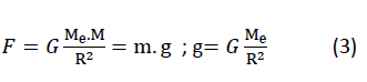
With F=attraction force in kg.m.s-2; G=the universal gravitation constant 6.674.10-11 m3kg-1s-2; Me, m=the mass of the Earth and of the body respectively in kg; g=the acceleration in m.s-2; R=the radius of the Earth in m.
Equation (3) shows that earth’s acceleration is independent from the mass of the body and is proportional to the Earth mass and radius. The acceleration of gravity is a conservative vector field, which implies that the work needed by a particle to go from point A to point B is independent from its route and is the product of the force of gravity by the displacement.
Gravity Method Application
The gravity method is based on accurate measurement of the vertical component of the Earth gravity field and their interpretation to detect underground variations of density. Toushmalani (2010) used gravity method in fault path detection. Considering two-dimensional view of the faults, three models considered with mat lab programming generated gravity, horizontal and vertical gradient charts due to these models. The result among others, around a vertical fault, there is a minimum and maximum. The position of the fault is the middle between minimum and maximum. Atef (2016) use bouguer anomaly map for delineating the subsurface structures and tectonic trends that have resulted in a potential heat source in southern part of the Gulf of Suez–Sinai region, Egypt. The gravity inversion revealed a good correlation between areas of high temperature gradients, high heat flow and positive gravity anomalies. The high temperature gradient and heat flow values suggested being associated with a noticeable hydrothermal source of heat anomaly located at relatively shallow depths which is expected to be due to the uplift of the basement in the area. Lilik (2016) using gravity method to studied of graben structure to identify the natural resources which may be available under the ground. Work was performed in various locations in Bogor and according to analysis using 2D Talwani model, the average density at the surface is 2.5 gram/cm3. 2D modelling results show a fault structure at rocks with relative direction West-East. The fault is forming an extension block faulting which makes the area a graben. Gravity data from GGMplus analyzed by SVD can be used to determine the type and trend of faults (Aziz, 2018). Guglielmetti (2019) conduct study focused on the processing and analysis of public data from the gravity Atlas of Switzerland to evaluate the possibility to use gravity as a standard subsurface investigation tool in the Geneva Canton to constrain the main geological features of geothermal interest. Be identified 4 main formations that are both geothermal relevant and show significant density variations which can be constrained by the gravity method: shallow quaternary deposit, Tertiary Molassic sediments, Mesozoic carbonates and deeper crystalline basement with embedded Permo-Carbonifer troughs. Modelling subsurface geologic structures, among others using gravity method could assist decision making regarding exploration and exploitation of geothermal at the Ikogosi geothermal field, southwestern Nigeria (Abraham & Alile, 2019).
Lineament Study and Geological Structures
Andrianaivo & Ramasiarinoro (2010) utilize satellite imagery, field investigations to characterize the age and the role of faults in the geothermal system of the volcanic area of Itasy. Based on the regional lineament studies, geological exploration, structural analysis, remote sensing and a geothermal GIS, the data acquired have significant implications for understanding the structural controls on the Itasy geothermal field. Regional structural lineaments (fault and fracture strikes) are consistent with the directions of the feature alignments. These master strike-slip faults, distributed across the Precambrian crystalline basement exhibit a pre-Pleistocene rupture history.
Fault and Fracture Density (FFD) is a simple method which is applied in geothermal exploration to locate highly fractured areas that assumed to be associated with geothermal reservoirs at the depth. In low terrain volcanic geothermal systems such as in New Zealand, the zones with high FFD values usually correlate well with thermal manifestations and associated subsurface reservoirs. Suryantini & Wibowo (2010) discusses the application of FFD in three geothermal systems in Sulawesi. The results show that the high FFD zones have no correlation with the occurrence of surface manifestation, low resistivity anomalies, or demagnetized bodies, which are the main common indicators of the occurrence of geothermal reservoirs at depth. Instead, thermal manifestations appear at the transitions from high to low density FFD contours, which reflects the flank or the slope of the terrain. Hence the occurrence of surface manifestation is also strongly controlled by regional hydrology, instead of structural geology. The subsurface reservoir consequently is suggested to be located at the transition of moderate to low FFD zones. This zone seems correlate well with horizontal derivative images from gravity data that indicates subsurface permeable fractured zone which is potential as reservoir. Bujung, et al., (2011) identified the surface structure of the geothermal area based on lineament density, magnetic anomalies, and geothermal manifestations on the surface. Surface structure analysed through lineament density on the surface with the Fault and Fracture Density method. This lineament is assumed associated with fractures or faults in geothermal areas which are generally covered by manifestations surface so it is difficult to be identified. This fault and fracture are assumed to be weak fields which becomes the path of movement of thermal fluid so that it can be a clue to the location of the area permeable or reservoir. Based on the FFD method which is compiled with geomagnetic data, it is known that the geothermal prospect area is in the Cibuni area, Kawah Putih-Kawah Ciwidey. Saepuloha (2018) studied lineament density extracted from dual orbit of synthetic aperture radar (SAR) images to detecting fluids paths in the Wayang Windu geothermal field (West Java, Indonesia). The calculated lineament distribution was spatially characterized by the intersection, occurrence frequency, and length densities of the lineaments. An ordinary kriging map of the lineament length density using 1 × 1 km cells showed good agreement with the geothermal surface features (hydrothermally altered zones, mud pools and hot springs), which were probably formed by highly permeable fractures and fluid ascent. The high-anomaly zones of length density overlapped two fluid ascent sites and three water recharge sites in the water and steam-dominated geothermal systems respectively.
Methodology/Materials
The work design is summarized in the flow chart in Figure 3.

Figure 3: The Work Design
Gravity Method
Correction of gravity data needs to be done before the survey results can be interpreted. This is because the gravitational method research shows the difference in the value of gravity from one place to another. The difference in the reading of the gravity value in a point on the surface of the earth is influenced by several factors including variations in topography, altitude variation, tides, and shocks on tool springs, latitude, and variations in subsurface density. The corrections used are:
1. Latitude correction
2. Tide correction;
3. Drift correction
4. Free air correction
5. Bouguer Correction
6. Terrain Correction
Bouguer Anomaly:
With, gobs=observed gravity (mgal)
gϕ=978031.85(1+k1sin2ϕ-k2sin22ϕ); gravity variation by lattitude
FAC=0.3086 h; Free air correction (mgal)
BC=0.04191 hρ; Bouguer correction (mgal); h=elevation, ρ=density (Mkg/m3)
Complete Bouguer Anomaly: ; TC=Terrain correction
Lineament Method
The method used is a digital elevation map analysis which is based on a contour map. Furthermore, shaded relief is made using light azimuths and light heights of 450, then lineament drawn. The lineament that has been drawn, is calculated its length value. Contour map of the fault and fracture density values is assumed that the highest structural density is associated with the center of fluid movement.
Withdrawal lineament from SRTM satellite images using ilwis follows the steps as follows:
1. Cut the image on scientific terms using georeference according to location coordinates
2. Limit using a 1 km x 1 km grid, then print
3. Drag the alignment based on the visible lines of the SRTM image.
4. Calculate the value of each grid and enter it in the table.
Results And Findings
Table 1 displays some of the results of gravity data processing; BA=Bouguer anomaly, BAC=Bouguer anomaly complete, FAA=Free-Air anomaly, and Table 2 displays some of the results of lineament data processing.
| Table 1 Gravity Data Processing Results |
|||
|---|---|---|---|
| Station | BA | BAC | FAA |
| 6 | 144.52 | 143.11 | 229.08 |
| 8 | 138.35 | 136.78 | 212 |
| 9 | 143.66 | 141.99 | 223.89 |
| 12 | 146.99 | 145.47 | 232.45 |
| 13 | 148.17 | 147.1 | 233.15 |
| 14 | 147.62 | 146.18 | 236.53 |
| 15 | 149.54 | 147.81 | 234.37 |
| 16 | 147.41 | 146.43 | 233.17 |
| 17 | 146.88 | 145.72 | 232.06 |
| 18 | 145.18 | 143.82 | 229.82 |
| Table 2 Lineament Density Value |
||
|---|---|---|
| x | y | z |
| 700500 | 129500 | 170 |
| 701500 | 135500 | 350 |
| 702500 | 136500 | 590 |
| 703500 | 138500 | 640 |
| 706500 | 130500 | 380 |
| 707500 | 130500 | 240 |
| 708500 | 132500 | 270 |
| 709500 | 133500 | 340 |
| 710500 | 131500 | 290 |
| 714500 | 134500 | 320 |
Elevation countour and Free air anomaly maps shows in Figure 4 and Figure 5. While Gravity Anomalies and Lineament density maps between Tondano Lake Caldera and Linow Lake Crater show by Figure 6 and Figure 7.

Figure 4: Elevation Countour Map

Figure 5: Free Air Anomaly Map

Figure 6: Gravity Anomaly Map

Figure 7: Lineament Density Map
Figure 5 and Figure 6 shows that the area with high bouguer anomaly values is east of Lake Tondano, with a distribution value of 154-168 mGal. Whereas for areas with low to medium bouguer anomaly values are in the southeast part of Lake Linow with a value of 124-150 mGal. The variation in anomaly values is caused by differences in the density of rocks scattered in the surrounding area, and between the Lake Tondano caldera and the Lake Linow crater. The higher the value of rock density, the higher the bouguer and free air anomaly values that are owned by the area. Conversely, the lower the value of rock density in the area, the lower the bouguer and free air anomaly values. In addition, variations in the value of bouguer anomalies and free air are also influenced by differences in topography in the caldera region of Lake Tondano and its surroundings, where there are highland and lowland areas. Areas that are highlands tend to have a bouguer and free air anomaly values greater than lowland areas.
Conclusion
The distribution of bouguer anomaly values increased to the east of Lake Tondano with a value of 154-168 mGal and decreased to the west of Lake Tondano with a value of 124-150 mGal. The variation of the bouguer anomaly value is caused by the difference in the density value of the rocks in the Lake Tondano caldera outflow and surrounding areas. The existence of a fault is known to be in the west of the Lake Tondano caldera which is an extension east to southeast of the crater of Lake Linow. There is a relationship between the distribution map of the bouguer anomaly value and the density distribution map of the alignment of the surrounding area and along the caldera of Lake Tondano to Lake Linow. The results of this study conclude that the development trend of geothermal energy exploration extends from the northwest of Lake Linow to the southeast of Lake Tondano.
References
- Abraham, E.M., & Alile, O.M. (2019). Modelling subsurface geologic structures at the Ikogosi geothermal field, southwesterm Nigeria, using gravity, magnetics and seismic interferometry techniques. Journal of Geophysics and Engineering, 16(4), 729-741.
- Altwegg, P. (2015). Gravimetry for geothermal exploration. Neuchâtel: University of Neuchâtel.
- Andrianaivo, L., & Ramasiariarinoro, V.J. (2010). Relation between regional lineament systems and geological structures: Implications for understanding structural controls of geothermal system in the volcanic area of Itasy, Madagascar. World Geothermal Congress 2010. Bali: Université d’Antananarivo.
- Atef, H., El-Gawad, A.A., Zaher, M.A., & Farrag, K. (2016). The contribution of gravity method in geothermal exploration of southern part of the gulf of Suez-Sinai region, Egypt. National Research Institute of Astronomy and Geophysics, 5(1), 173-185.
- Aziz, K.N., Hartantyo, E., & Niasari, S.W. (2018). The international conference on theoretical and applied physics. Journal of Physics: Conference Series, 1011.
- Bujung, C.A. (2011). Identification of geothermal prospects based on Fault and Fracture Density (FFD): Case study of mount patuha, west java. Journal of the Environment and Geological Disaster, 2(1), 67-75.
- Effendi, A.C., & Bawono, S.S. (1997). Ecological map sheet Manado, North Sulawesi Geological map of the Manado Sheet, North Sulawesi.
- Guglielmetti, L., & Moscariello, A. (2019). European Geothermal Congress 2019. Application of the gravity method to constrain.
- Hasanah, L., Aminudin, A., Ardi, N.D., Utomo, A.S., Yuwono, H., & Kamtono (2016). Graben structure identification using gravity method. International Symposium on Geophysical Issues.
- Imam Raharjo, E.S. (2009). “Quick and Dirty” 3-D Gravity Inversion – A case study in Lahendong and its vicinity. Geothermal Pertamina.
- Ministry of Environment and Forestry (2015). Lake Tondano rescue movement (Germadan). Tondano: Ministry of Environment and Forestry.
- Kipkemoi, L.G. (2013). Gravity survey for geothermal exploration in menengai area, Kenya. Nairobi: Kenyatta University.
- PT LAPI ITB. (2009). Re-assesment reservoir area kamojang, lahendong & sibayak. PT: Pertamina Geothermal Energy.
- Saepuloh, A., Haeruddin, H., Heriawan, M.N., Kubo, T., Koeike, K., & Malik, D. (2018). Application of lineament density extracted from dual orbit of synthetic aperture radar (SAR) images to detecting fluids paths in the Wayang Windu geothermal field (West Java, Indonesia). Geothermics, 72, 145-155.
- Siahaan, E.E., Soemarinda, S., Fauzi, A., Silitonga, T., Azimudin, T., & Raharjo, I.B. (2005). Proceedings world geothermal congress 2005. Tectonism and Volcanism Study in the Minahasa Compartment of the North Arm.
- Suryantini, & Wibowo, H.H. (2010). Application of Fault and Fracture Density (FFD) Method for Geothermal Exploration in Non-Volcanic Geothermal System: A Case Study in Sulawesi-Indonesia. Journal Geoapplications, 27-37.
- Toushmalani, R. (2010). Application of gravity method in fault path detection. Australian Journal of Basic and Applied Sciences, 4(12), 6450-6460.